Aerial image acquisition provides a wealth of vital information that enables clients to plan, interpret and make well-informed decisions. Bowman invests in the latest cutting-edge technology to collect, analyze, and process data to deliver high-quality and distinctive data of otherwise inaccessible areas. Using Unmanned Aircraft Systems (UAS), our team of experts leverage current technologies to streamline conventional data collection processes and provide deliverables that rival that of traditional photogrammetry and LiDAR data services, particularly for small to medium size projects.
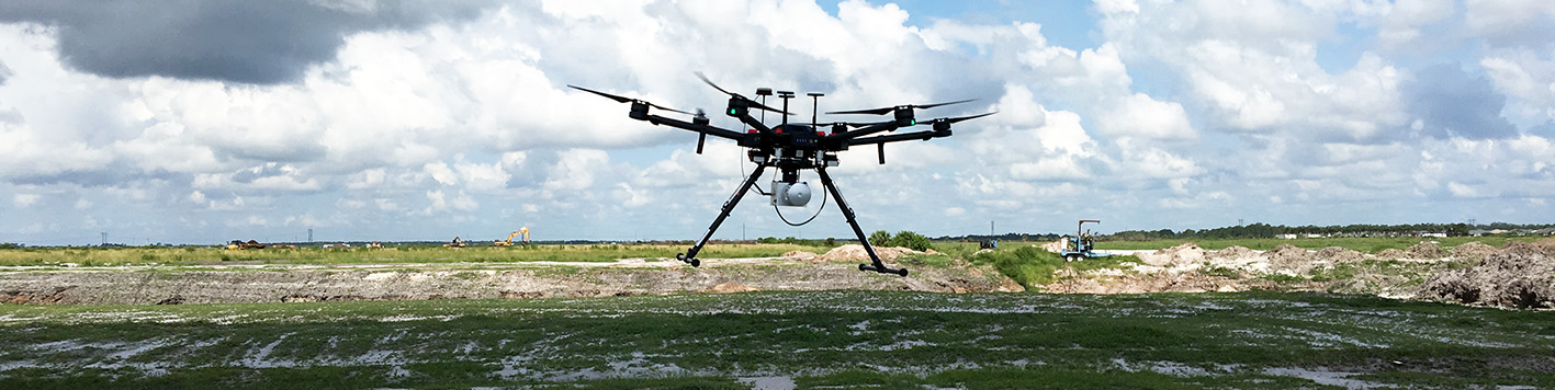
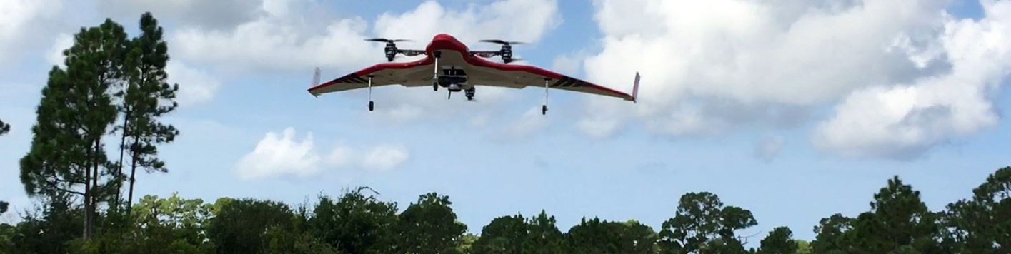
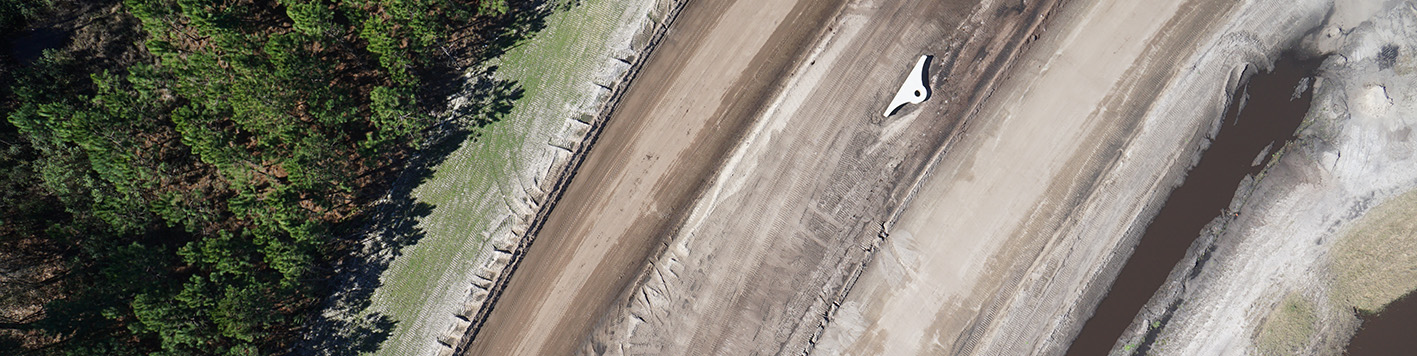
Bowman utilizes an advanced fleet of over 20 cutting-edge UAV. Long endurance fixed-wing UAV with RTK capabilities, such as the eBee X and BirdsEyeView FireFLY6 Pro, can map hundreds of acres per flight with high accuracy. Bowman uses heavy lift UAV, such as the DJI Matrice 600 Pro, to carry various LiDAR payloads. For 3D modeling and infrastructure inspections, Bowman utilizes high-resolution, 100-megapixel Phase One cameras providing the highest imagery resolution possible on a UAV.
Our clients profit from our vast knowledge of contemporary procedures including planimetric and topographic mapping, Digital Terrain Modeling (DTM) and automated 3D point clouds. Our services include:
Our UAS mapping team is managed by our in-house photogrammetrists who offer vast experience and are equipped to provide a full range of services to our clients in accurately measuring spatial features from aerial photography and remotely sensed data. Clients profit from these modern procedures including:
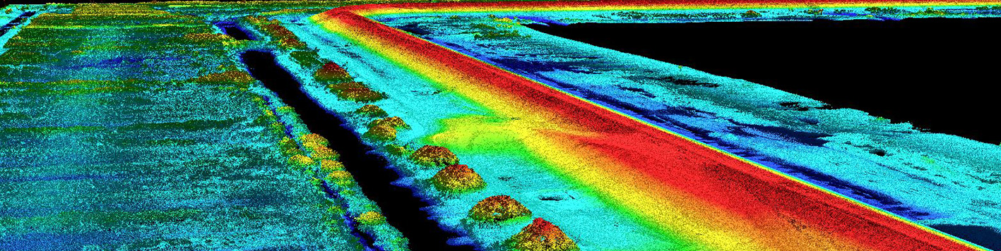
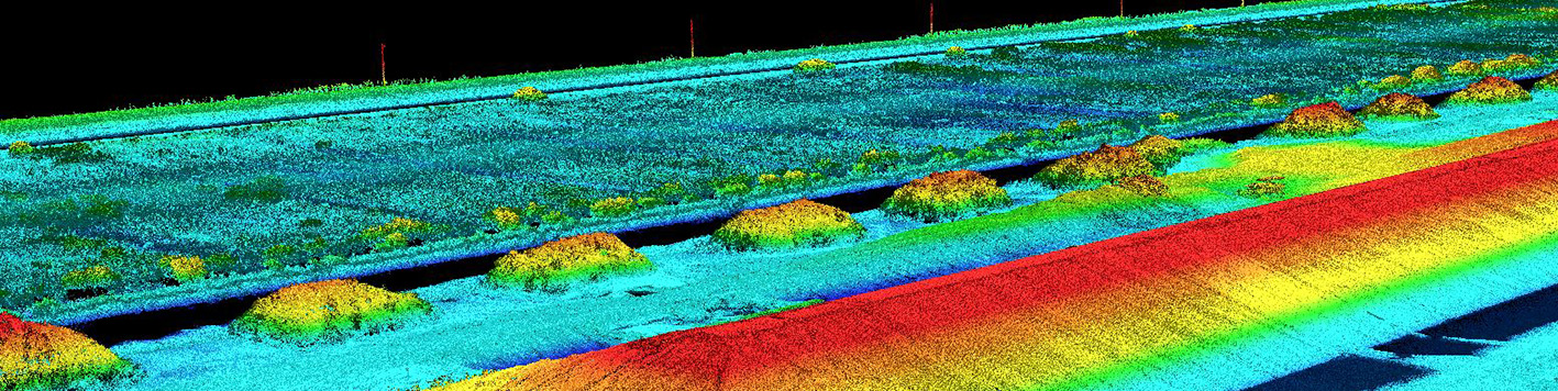
LiDAR technology is commonly used in measuring the height of land, buildings, trees and other objects. LiDAR is a high-tech surveying method that measures distance to a target by illuminating the target with laser light and measuring the reflected light with a sensor. Differences in laser return times and wavelengths can then be used to make digital 3D representations of the target. Bowman has full-service LiDAR capabilities including:
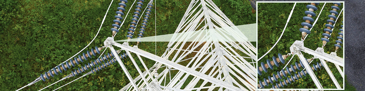
Manual utilities inspection typically requires more equipment and manpower to collect less detailed and less flexible data. UAV utility inspections can help reduce various risks and provides a physically safer inspection process for the inspectors, minimizes disturbance to the site and surrounding environment, and easily allows access to hard-to-reach locations.
Multi-spectral imaging captures images of things you can’t see. Bowman utilizes special cameras that capture light from a narrow range of wavelengths across the electromagnetic spectrum, including frequencies that are invisible to the human eye.