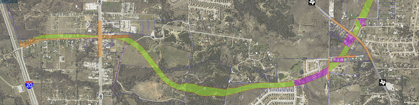
Provided boundary, aerial, and topographic survey for approximately eight (8) miles of a prosed road (loop) around the City of Weatherford. The team set aerial panels throughout the project area and managed the aerial flight of the project.
The coordinates of the aerial panels were established using GPS and scaled to the Texas Department of Transportation surface coordinates. The aerial flight included the planimetrics (2D features), a digital terrain model (.dtm) of the project, and orthophotos. We performed the QA/QC of all data prior to submittal to the client.
Our team also performed the boundary survey of approximately four (4) miles of the proposed route and obtained copies of subdivision plats and ownership deeds within the project limits. Boundary monuments were recovered and a property map was created. Included in the boundary survey were fifty (50) right-of-way acquisition documents with legal descriptions, signed and sealed by a Registered Professional Land Surveyor.
After documents were completed, monuments were set delineating the proposed right-of-way. We also staked the proposed right-of-way for property owners and appraisers to see the new route and new fences. ASCII point files and Microstation files were submitted for planimetrics, boundary, topography and TIN/DTM to client standards.
Our team worked with engineers, land men, title agents, property owners, and other land surveyors in order to complete this project. Property owners were notified prior to accessing their land. The team also performed the survey of the Level A and Level B utilities that were marked by a private subsurface utility engineering firm. This included surveying the locations of the marked utility lines, test holes, and locations of all surface utilities within the project limits.