
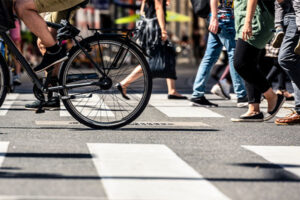
As cities across the US work to provide more sustainable, inclusive transportation options, infrastructure for people walking and biking is increasingly front and center. Whether it’s redesigning busy intersections to improve safety or identifying missing connections in a street network, these projects go beyond engineering to shape places where people feel comfortable moving by foot or bike.
We take a collaborative approach to solving these challenges. To explore how we do this, we sat down with Natalie Press, project manager of community transportation, for practical advice for communities looking to improve walking and biking options.
Q: Can you share an example of a project focused on people walking and biking that transformed local mobility?
A: The Inman Square safety improvement project in Cambridge, Massachusetts transformed a complicated, high-crash intersection into a safer, more accessible space for walkers and bikers. Bowman helped reconfigure one large, confusing intersection into two smaller, more navigable intersections, adding separated bike lanes, bike signals and expanded sidewalk and plaza space. As someone who lived nearby and walked and biked through regularly, I saw firsthand the positive impact these changes made.
Q: That project involved a lot of coordination. How does Bowman work across disciplines on projects like this?
A: We kick things off by bringing planning, traffic and design folks together early so everyone’s on the same page. For Inman Square, that meant starting with a look at how people were currently using the street—for example, the number of people walking, biking, driving and riding the bus, as well as understanding how space along the curb was being used. This information helped to inform how roadway space could be reallocated to better accommodate the people using it and create a safer environment for everyone. From there, our team developed ideas for potential intersection configurations, with the traffic team analyzing different lane and signal setups, and the design team turning those into workable street layouts. It’s less about working “across” disciplines and more like working as one integrated team.
Q: What’s the first step a city should take to improve connectivity for people walking and biking?
A: Start by understanding what you have. That means creating a current, digital inventory of sidewalks, paths and bike facilities. Having that data in a format like GIS helps consultants like us jump right in and start identifying opportunities and gaps.
Q: What challenges come up when designing infrastructure for people walking and biking, and how does Bowman navigate them?
A: Space is the biggest challenge—especially in older cities. Streets are often narrow or lined with features that are difficult to change, so we look for smart compromises.
One example is integrating separated bike lanes at bus stops, creating a floating bus stop, even when a fully separated bike lane may not be possible throughout a corridor. It works well because bikers are routed out of the bus’s path, and bus passengers have a clear waiting area. It creates a safer and more efficient environment for multiple types of people using the same space.
About Natalie Press, AICP
Natalie Press is a project manager with over ten years of experience in transportation planning, with a strong focus on making streets safer and more accessible for walkers and bikers. Her work includes developing multimodal master plans, leading corridor studies and evaluating strategies that support active transportation and reduce car dependence.
Share