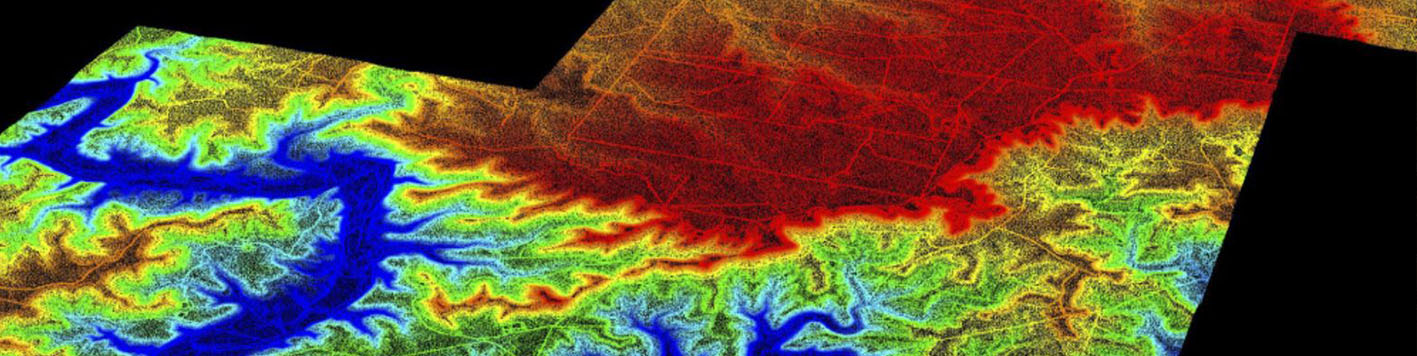
Kings Creek Wind Farm was a hard bid, multi-phase aerial and ALTA survey for an approximate 50,000-acre wind farm. The scope consisted of a manned aircraft aerial survey to collect ortho imagery and an on-the-ground boundary survey to produce ALTA surveys for all project parcels. For the first phase, we flew the 50,000-acre site with a fixed-wing, manned aircraft to collect high resolution orthoimagery and Lidar data. The Lidar was processed to create a point cloud, from which a topographic survey was generated. A planimetric survey was also created from the orthoimagery data, and both were delivered in CADD and GIS .shp files.
The ALTA boundary surveying phase of the project presented many unique challenges. Access to the property was dependent upon scheduled hunters on the ranches and had to be coordinated to prevent overlapping survey crews with hunters creating a potentially dangerous situation. These considerations were managed, and the project timeline goal was met. Additionally, the ranches were being operated as natural habitat restoration properties, meaning our on-the-ground work was performed as “Leave No Trace” so that no disruption of the natural habitat or prairie grasses occurred. The boundary work was complex as much of the site had not been surveyed since the mid-1800’s, and as such, required extensive research and coordination with the General Land Office of the State of Texas. Original Texas Land Surveys, where the property was separated from the sovereign, were analyzed and relied upon for boundary reconstruction of the parcels involved, which meant retracing 150-year-old field notes and locating original stone mounds, witness trees, and other ancient evidence to locate the parcel boundaries.