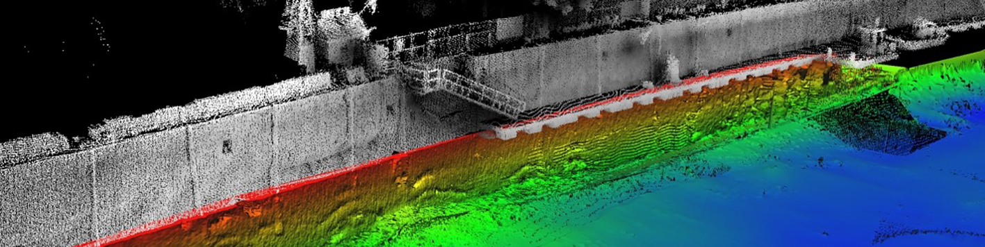
Our team performed a combined multi-beam side scanning sonar and LiDAR investigation to produce 3D digital model of the vertical surface of the Troy seawall above and below the water surface. This continuous model produced a high resolution “picture” of the wall.
We provided deformation analysis on the target regions of the wall to determine the extent of section loss and overturning. The results of the wall scanning were used to direct the extent and focus of the subsequent underwater diving inspection work to obtain more detailed information. The comparison/validation of results by the divers was considered to be very accurate in location and extent of deterioration.
The team utilized its state-of-the-art, fully dedicated, survey vessel for this project, Atlas. Atlas is permanently fitted with all of the required equipment to carry out a real-time, high resolution bathymetric survey. All of the positioning and survey systems on the vessel are maintained by our team in a fully calibrated and ready to deploy state.