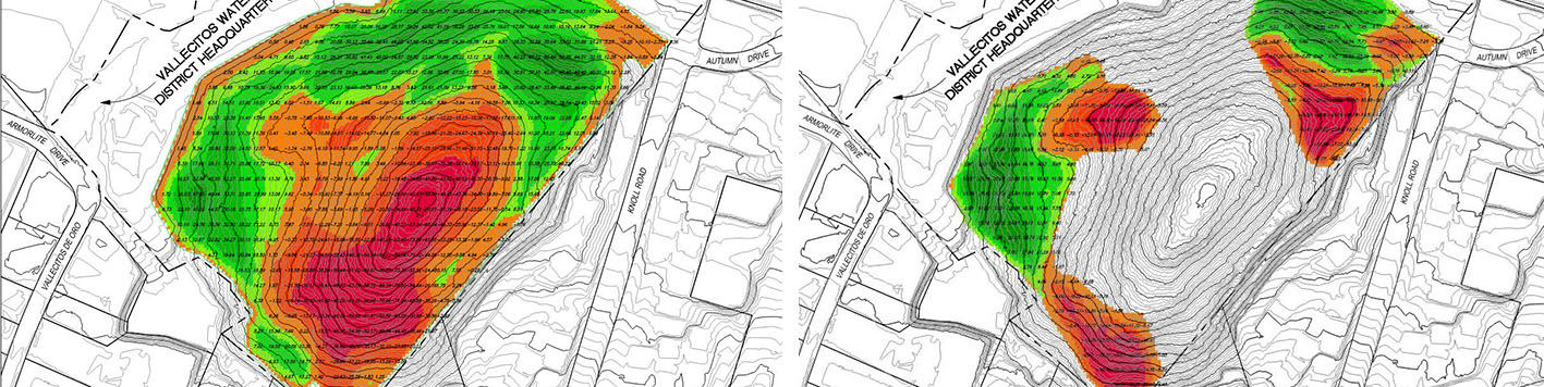
The Vallecitos Water District had surplus land that is highly constrained that they wanted to find the highest and best use of the parcel for. Our landscape architects analyzed and evaluated the property based on access, steep slopes and biological sensitive habitat. Our analysis was for two types of development: one to minimize the disturbance and the developable pad, and the other to maximize the developable pad.
The minimal alternative was an environmentally sensitive layout with the least amount of impact to the steep topography and habitat, but yield for a development area. The second alternative was to re-grade the entire site to maximize the developable pad areas. The improvement costs for the two alternatives were evaluated with respect to their land uses. Estimates were prepared for the roadways with sewer, water, storm drain utilities and the amount of earthwork to be moved. Earthwork models were prepared using Civil 3D to determine the volume of cubic yards of dirt to be moved. Both estimates were analyzed comparing the cost versus the potential revenue that could be obtained for the developable pad. A comprehensive report was prepared and presented to their board for a determination as to how to proceed.