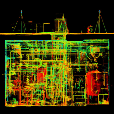
As reality capture technology becomes more accessible and widely adopted, clients are increasingly faced with a critical question: How accurate does the data really need to be? Striking the right balance between precision and practicality can dramatically impact project cost, efficiency and overall value.
In this Q&A, Kolin Robert, branch and office leader for reality capture at Bowman, shares how his team helps clients determine the right level of detail for each project. From market trends to data usability, Kolin explains how aligning technology with client intent leads to better outcomes—and why thoughtful planning is just as important as the tools themselves.
Q: How does balancing precision and practicality in data collection impact overall project efficiency, cost and turnaround time?
A: Balancing precision and practicality is one of the most critical decisions in any reality capture project. The level of accuracy directly influences not only cost and schedule but also how efficiently downstream teams can use the information. Capturing every surface to millimeter precision can sound ideal, but it often introduces unnecessary complexity, larger datasets and longer processing times—without delivering proportional value.
By right-sizing accuracy to the project’s needs, teams can streamline field efforts, reduce data volume and accelerate deliverables without sacrificing integrity. The key is to define “fit-for-purpose” accuracy early on, aligning expectations between field, modeling and design teams. That alignment ultimately drives efficiency: the right precision, applied in the right places, leads to better decisions, faster workflows and more cost-effective results.
Q: What trends are shaping the future of reality capture technology, and how is Bowman positioning itself to lead in this space?
A: Reality capture is evolving from isolated data collection into fully integrated digital workflows. It’s no longer just about capturing a snapshot in time, but about connecting that information into design, construction, operations and maintenance systems in near real time. This shift is driven by the rise of digital twins—dynamic platforms that combine historical drawings, live sensor data and 3D models into a single intelligent environment.
Clients and owners are leveraging this integration to support facility management, asset performance and long-term planning. The focus is shifting from documenting spaces to enabling better, data-driven decision-making across the entire lifecycle of an asset.
At Bowman, we view reality capture not as an add-on, but as a core pillar of project delivery. We’re aligning our geospatial, technology and engineering teams to meet this growing demand. By combining aerial, terrestrial, mobile, underwater and underground data capture with traditional surveying and engineering design, Bowman delivers comprehensive, connected solutions that bridge the physical and digital worlds.
Q: As reality capture tools evolve, what strategies is Bowman using to ensure clients are still receiving highly usable, accessible data—not just more data?
A: There’s a wide spectrum of capture technologies today—from ultra-high-precision instruments to rapid, large-scale mapping systems—and manufacturers continue to push the limits on both ends. But data capture is only half the equation. The true value lies in delivering information that’s usable and directly applicable to client needs.
Bowman’s focus is on transforming complex spatial data into clear, purpose-driven deliverables that fit seamlessly into client workflows. Whether it’s a Revit model, CAD documentation or a fully integrated digital twin, our goal is to provide the accuracy and format that support the next step—not just more data.
We start by asking: Why are we capturing this? What decisions will it inform? How will it be used? That understanding shapes the entire process, from capture method to deliverable. By prioritizing usability and compatibility, we ensure our deliverables don’t just document existing conditions—they enable downstream design, management and decision-making to move forward with confidence.
Q: What challenges do clients sometimes face when defining their desired level of detail, and how does Bowman guide those conversations?
A: One of the biggest challenges is defining what level of detail is actually needed. Most clients know they want accuracy, but “accurate” can mean very different things depending on whether you’re planning, designing, fabricating or managing a space. Without the right context, it’s easy to overshoot—driving up cost and turnaround time—or undershoot, resulting in data that’s not useful.
Another challenge is familiarity. Reality capture is still new for many owners, architects and engineers. Some have used it before, some haven’t. We spend a lot of time helping clients understand what’s possible, what’s practical and how to scope their efforts appropriately.
Our approach starts with a conversation—not about the scanner or the spec, but about what they’re trying to achieve. Once we understand that, we can guide them toward the right level of precision, tools and deliverable format. Often, the greatest value we bring isn’t in the scanning itself, but in helping clients bring the service into their projects with confidence.
Q: Looking ahead, how does Bowman see client expectations evolving around precision, practicality, and cost-effectiveness in reality capture services?
A: The industry is growing fast, and client expectations are evolving just as quickly. As technology becomes faster and more affordable, clients expect refined, integrated solutions—not just raw data but live, connected insights—while maintaining the same trusted levels of quality and accuracy. We’re seeing more clients request deliverables that not only document assets, but help manage them day to day. Static drawings and models are no longer the endgame.
Bowman is responding by aligning its geospatial and engineering disciplines to deliver full-lifecycle solutions. It’s no longer just about capturing data and walking away—it’s about building systems that evolve and add value long after the initial deliverable.
About Kolin Robert
Kolin Robert is branch and office leader for reality capture at Bowman, where he draws over a decade of experience in the AEC industry to help clients see their projects with clarity and precision. Specializing in reality capture technologies, he focuses on terrestrial and SLAM-based lidar to deliver accurate models that support engineering and architectural planning and design. His experience also extends across aerial and mobile lidar, photogrammetry and conventional survey methods, providing project teams the reliable data they need to make informed decisions from design through construction.


