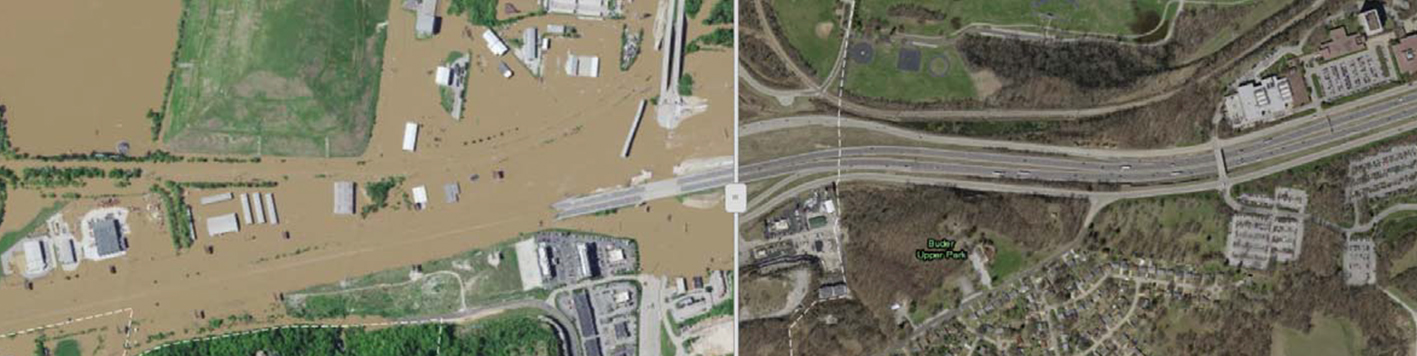
From emergency responders to local authorities to insurance companies, those responding to the flooding of Missouri’s Meramec River could access imagery within 30 hours of acquisition. Despite tremendous rains and poor atmospheric conditions, Our team was able to capture critical imagery to help the community quickly respond to the disaster.
Missouri’s Meramec River is one of the largest free-flowing waterways in the state. Its meandering 220 miles drains nearly 4,000 square miles in a watershed covering six Missouri counties. In late April 2017, the St. Louis region experienced exceptionally heavy rains. In Sullivan, MO, nearly 7 inches of rain fell from April 29 through May 1. Local authorities watched with concern as the rivers swelled beyond capacity. Being a St. Louis County-based team, we monitored the flood waters and was able to conduct aerial imagery acquisition — despite the exceptionally cloudy and rainy conditions – to pull together a complete coverage of the flooded area for local communities and disaster recovery officials.
With the projection that the flood would crest early on Wednesday, May 3, we acquired aerial imagery on May 2nd, processed the images, and provided web services containing the orthoimagery within 24 hours.
The Meramec crested on Wednesday, May 3rd, at 36.52’, breaking the over 100 year record by three ft. This was preceded by a crest of 31.48’ on December 19, 2015 — essentially exhibiting two nearly “100-year” floods within a 16-month period. The Meramec Caverns attraction was again temporarily closed , along with several campgrounds, boat access areas, etc. Our team was able to capture the imagery at a timely point during the flooding and use our tested emergency response processes to ensure expedited products to the government and the public.