Securing usable aerial imagery as soon as possible after a severe weather event can enable civil and emergency response personnel to respond more quickly and efficiently, and our team has a proven procedure for this very situation.
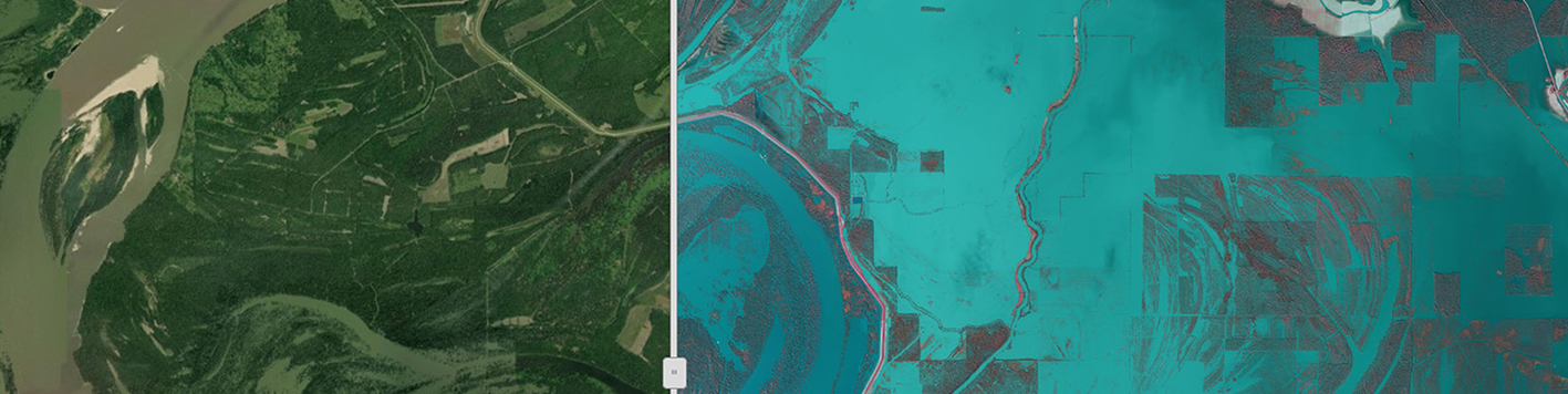
In March of 2019, several large areas in the central part of the United States experienced significant flooding, and there was a pressing need to assess the extent of the flooding. The U.S. Army Corps of Engineers (USACE) St. Louis District turned to us, emphasizing the urgency for rapid acquisition of aerial imagery. The task order was to acquire 1,248 square miles of 1’ GSD 4-band color aerial imagery of the Mississippi River above Vicksburg, MS.
To achieve quick turnaround, our team shifted aircraft from other projects to acquire the imagery, and then performed basic, largely automated processing of the imagery. Within 26 hours of acquisition, the imagery was served on a Web Mapping Service (WMS) and available to various users designated by the USACE. Users could access the imagery from the web with any computer or mobile device through a standard web browser; no special software was required.
The USACE was so pleased to have imagery for the Vicksburg project completed and online so quickly, they issued a second task order for flooding imagery, with the same specifications but of an area over twice the size as the first area – 3,465 square miles (of the Missouri River from Omaha to central Missouri). Following the same processes, our team had imagery uploaded within 48 hours of acquisition.
With several terabytes of flooding imagery online within hours of acquisition, the Corps was able to share important information – which areas were already flooded, how much volume had accumulated, how far it will flood at the current rate of precipitation – with affected government entities during a critical decision-making period.
This rapid emergency response was possible due to several factors:
- Our team has sufficient acquisition capacity to shuffle aircraft quickly, with nominal impact on other projects, to address an emergency situation.
- Our fleet includes aircraft that can mobilize with enough speed to be in the project area in a timely manner.
- Our orthoimagery department can shift resources to focus on emergency response projects quickly.
- Our R&D department has developed both the automated image processing as well as the WMS.