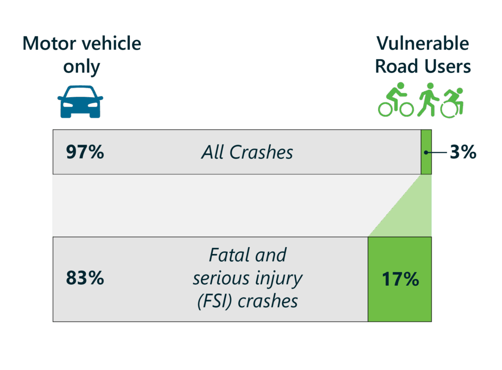
Like many communities across the country, the City of Chicopee, Massachusetts (the City), faced a growing concern about roadway safety and the need to proactively address fatal and serious injury crashes. The City’s fatal crash rate is among the highest in the state—more than double the state average, with 11 fatalities in 2022 alone. The safety risk is greatest for the City’s most vulnerable road users, including pedestrians and bicyclists—who are disproportionately harmed by crashes. One death or serious injury is too many, and for a community of approximately 55,000 people, such a high number of serious crashes on Chicopee’s streets underscored the urgent need for action.
To address these safety concerns, the City engaged Bowman to develop a Safety Action Plan (SAP) aligned with the Federal Highway Administration (FHWA) Safe Streets and Roads for All (SS4A) grant program. The City’s goal was to eliminate traffic-related deaths and serious injuries in Chicopee. To build an effective plan to achieve this goal, the City needed more than just crash statistics, but a planning process that combined technical analysis and public engagement to create an actionable roadmap towards safer streets for all users.
Challenge: Reaching Every Voice in the Community
Chicopee’s roads carry many users, including drivers, pedestrians, bicyclists, bus riders and people who use wheelchairs or other mobility devices. These users all navigate a network of streets with a history of fatal injury crashes occurring at concerning regularity. Identifying where and why these crashes occurred and translating that information into implementable improvements required a plan that could speak the technical language of a federal grant program while reflecting the voices of Chicopee’s diverse community.
Doing that well would require more than a standard online survey. Chicopee is a demographically diverse city, and reaching residents who face language barriers or limited digital access demanded a creative, multilingual outreach strategy designed to capture lived experiences that crash data alone cannot tell.
Solution: Building a Community-Driven Safety Strategy
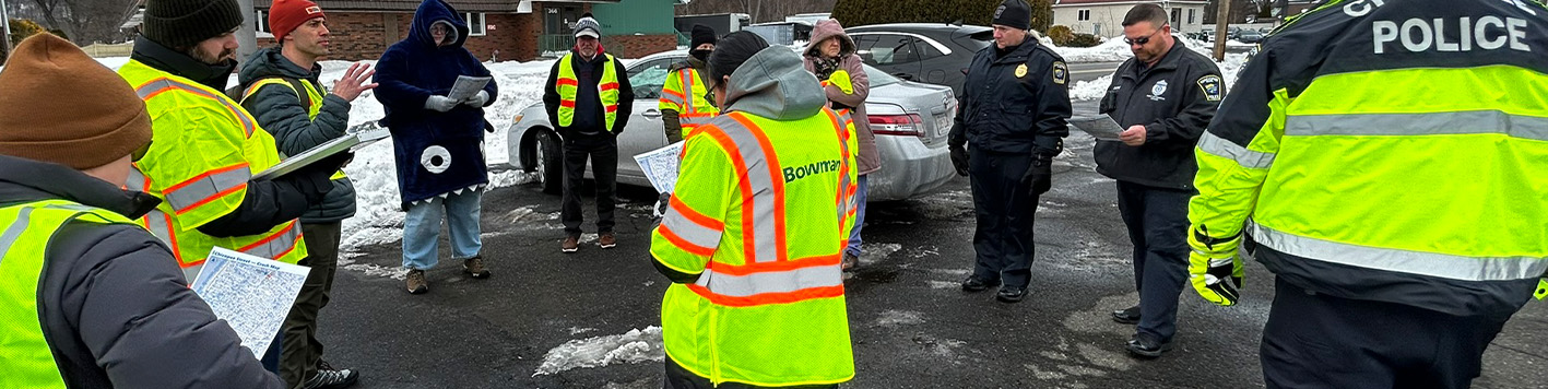
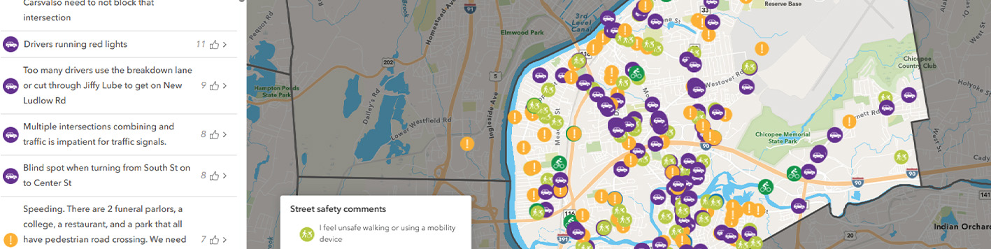
Bowman worked with the City to deploy a multifaceted engagement strategy to ensure broad community participation and equitable access to the planning process. Outreach efforts included an interactive online website and comment map, community events and mapping activities, a focus group with Chicopee teens, site visit workshops with community members and local stakeholders, a multilingual voicemail line and direct email submissions. Postcards were mailed to every residential address in the City with information on the plan and details on how the community can contribute.
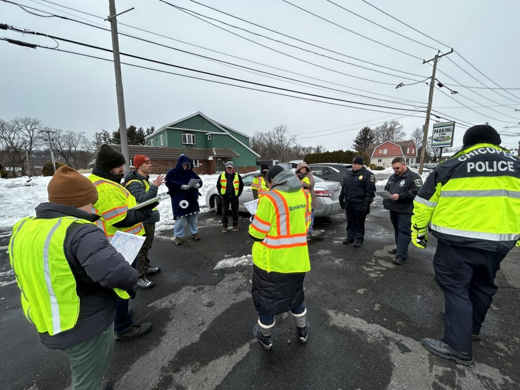
These tools generated substantial public participation, including more than 375 online map comments, 50 voicemails and 50 emails from residents identifying safety concerns throughout the City.
The input was integrated with thorough analysis of historical crash data, roadway characteristics and systemic risk factors to develop Chicopee’s High-Injury Network (HIN), which identified areas with the greatest potential for severe crashes and helped prioritize future safety improvements.
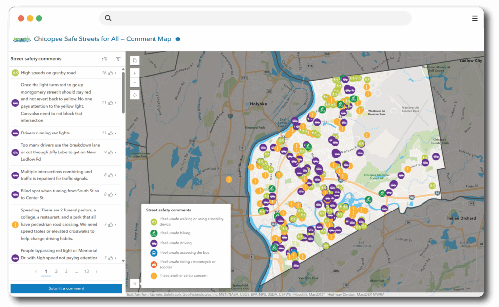
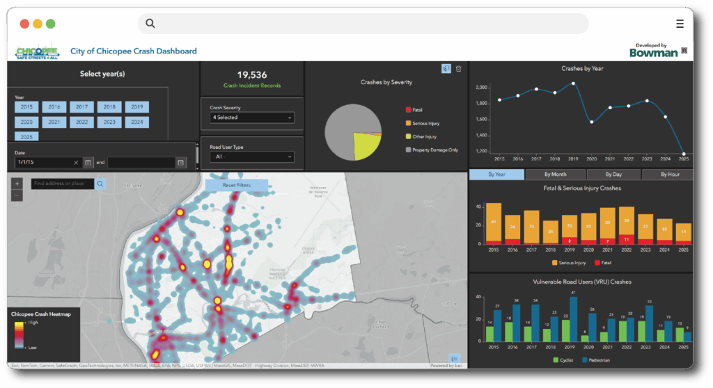
Throughout the planning process, Bowman collaborated with the City’s Safety Action Task Force to guide decision-making, shape recommendations and develop an interactive Safety Action Plan Dashboard that visualizes crash trends, tracks progress toward safety goals and supports long-term stakeholder engagement.
Impact: A Roadmap for Safer Streets & Future Funding
The final Safety Action Plan positions Chicopee to fix problematic roads and to secure funding for improvements. The plan’s alignment with the SS4A framework also puts the City in a strong position to pursue future federal funding.
Beyond the plan itself, the engagement process fostered stronger connections between residents and City leadership, ensuring community voices remain central to future transportation safety decisions. With the addition of the interactive Safety Action Plan Dashboard, the City is equipped with a long-term tool to track progress, support transparency, and sustain momentum toward its vision to eliminate fatal and serious injury crashes across Chicopee.
More information about the plan can be found below.