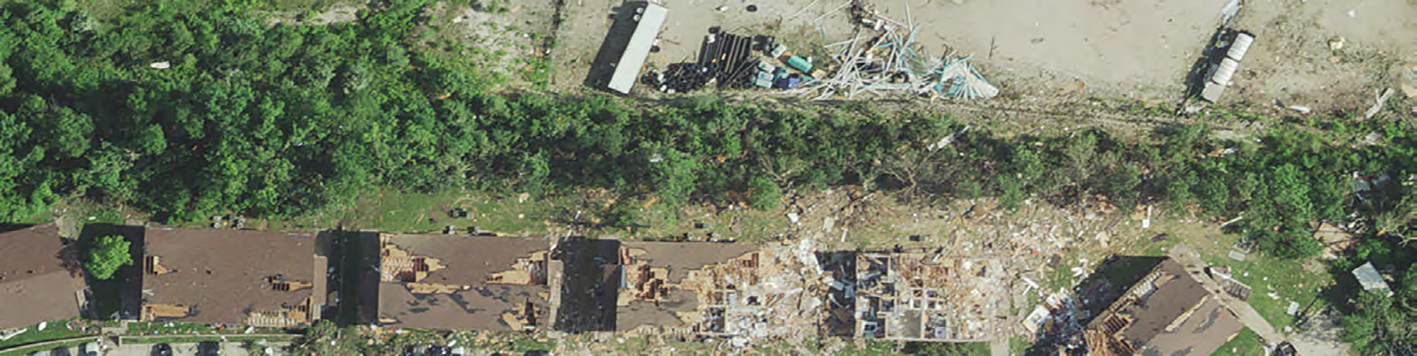
On May 22, 2019, an EF-3 tornado hit Jefferson City, MO. Within a few hours, several geospatial entities within the state established a data acquisition plan. Because of the emergency nature of this project, it was essential to provide data as quickly as possible to assist first responders in relief and recovery activities.
The project included two datasets: 6” ground sample distance (GSD) aerial imagery and 2 points per square meter (ppsm) lidar data. Our team acquired both datasets for 56 square miles of damaged area and posted both datasets to a web service within 24 hours of acquisition.
The Missouri GIS Advisory Council (MGISAC) enabled communication between various geospatial entities in the state, which worked together to quickly develop a plan for aerial data acquisition. The state of Missouri had an existing statewide contract for photogrammetric mapping products and services with our team.
This contract enabled the State to reach out to us to relay the acquisition plan and establish a project on May 23rd, just hours after the tornado. The strength and resolve of this network enabled acquisition to commence as soon as possible after the tornado—on May 24th. We sent two aircraft to the area in order to simultaneously capture imagery and lidar data.
After collecting both datasets, our team implemented our rapid response disaster mapping procedures so that we could hand off the data to first responders and others who needed to assess the damage as soon as possible. We posted orthoimagery to our web service within 12 hours of acquiring the data, and lidar data within 24 hours of acquisition. In addition to ourweb service, two other servers hosted the disaster mapping data. Missouri Spatial Data Information Service (MSDIS) and Esri posted the orthoimagery and lidar data to their sites, enabling a larger number of users to view the data simultaneously without risk of excessive lag or server crashes. Providing these datasets quickly using a reliable network enabled more effective response and recovery efforts by first responders, as well as more accurate damage assessment.