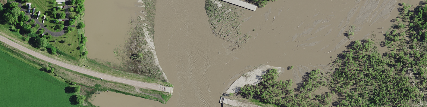
Our team has helped fulfill several geospatial products and services contract V3 (GPSC3) task orders for the U.S. Geological Survey (USGS). Typically, these task orders include QL2 Lidar data (4ppsm, among other requirements). In spring of 2019, however, we were awarded a task order for 6” imagery and QL1 lidar data (8ppsm, among other requirements) of a region of Nebraska that was experiencing flood conditions. This GPSC3 project was part of the risk mapping, assessment and planning (MAP) program run by the Federal Emergency Management Agency (FEMA). The project area included approximately 3,700 square miles of imagery and 3,300 square miles of lidar data of the Missouri and Platte Rivers and their watersheds.
We received the notice to proceed for this emergency response project on May 24, at which point we had completed two of the five river flooding projects we did for the U.S. Army Corps of Engineers – St. Louis District in the spring and summer of 2019. Our recent experience with emergency response projects helped us design and execute the USGS project more effectively, providing critical, high quality data in a timely manner.
Our team performed all imagery acquisition and processing as well as most of the Lidar acquisition (approximately 3,100 square miles) for this project. In order to enable capture of peak flood conditions, typical orthoimagery acquisition specifications for no clouds or haze, etc. were not required for this project. With the understanding that quick access to data is critical with weather emergency situations, we processed the imagery and posted it to our web service, SurCheck, within two days of acquisition. The Lidar data was processed over a longer timeline; this data was gathered for future planning. By providing data that met all specifications, within the requested timeline, we gave FEMA the ability to track and respond to the flooding situation more efficiently.