
Our team provided subsurface utility engineering, professional surveying, civil engineering and UAV services to support the planning, design and construction of a new fully redundant optical fiber campus technology loop for the roughly 100 acre developed portion of the state’s campus in Las Vegas, NM. We have been involved in the overall master planning of the campus beginning in 2012 with a range of topographic, utility, boundary surveying services.
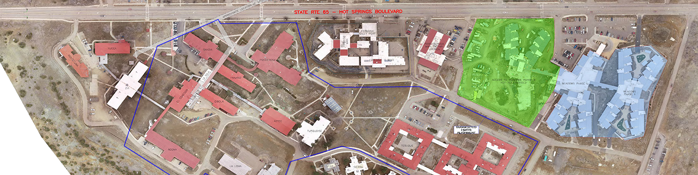
The study/pre-design (phase 1) of the Fiber Loop project was completed in July of 2020. Our subsurface utility department researched available record drawings and conducted utility designation (line-spotting) for detectable utilities for the entire campus. Following designation, our surveying department re-established the survey control used for previous surveying and mapping work at the site and employed a UAV (drone) to obtain current aerial imagery and generate a digital orthophotograph that captured the utility designation marks and current site conditions. On-the-ground surveying was conducted to collect site utility data and a comprehensive site utility survey was issued to document existing utilities. This overall site planning tool was then used by the design team and our civil engineering department to determine the best routing for the new fiber installation, and facilitate a preliminary alignment plan to support the Phase 2 design.
Phase 2 services in 2021 included hydro-jet excavation (potholing) for approximately 105 locations where critical utility crossing information was required, followed by a supplemental topographic & utility survey of the Fiber Loop Corridor and the individual building service connections. Our team then prepared an alignment and trenching plan for the new installations.
Phase 3 (construction) services included construction surveying (layout) for the proposed improvements, construction phase private utility designation for state-owned utilities that are not designated through the NM811 process, and limited observation services by making periodic site visits. Upon completion of the project, tour subsurface utility department designated the new lines and we conducted an as-built survey that will be the basis for preparing record drawings. We compiled the existing and newly constructed utility information and mapping into an ARCGIS-based web map that the state can use to document the project and use as a dynamic tool moving forward in facility operations, planning and maintenance.