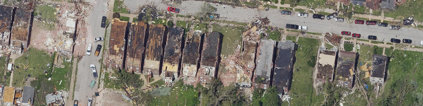
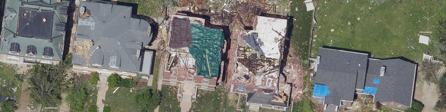
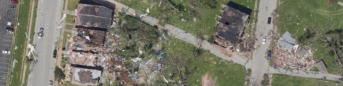
Within 24 hours of a tornado that struck downtown St. Louis in May 2025, Bowman mobilized its disaster mapping team from a local hangar to capture post-event aerial imagery. Using a Cessna Conquest aircraft equipped with a Phase One PANA imaging system, the team captured high-resolution, georeferenced imagery across the affected area.
Bowman processed the imagery into seamless orthoimagery products using ESRI visualization tools, enabling local agencies, insurance providers and relief organizations to conduct timely and accurate damage assessments. These stitched visuals provided a reliable foundation for prioritizing response efforts and supporting claims documentation.
Bowman was uniquely positioned to respond rapidly. Our local presence, in-house aviation capabilities and specialized imaging technology allowed us to bypass typical mobilization delays and deliver critical data while many were still surveying the damage on the ground.
View the story map and learn more about our response to the 2025 St. Louis tornado HERE.