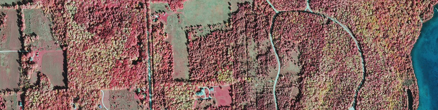
State agencies responsible for forest management benefit greatly from aerial imagery, which serves as a tool for monitoring the extent, species makeup and condition of forests. Color infrared (CIR) imagery acquired in the fall is particularly useful because it allows forestry professionals to more accurately determine the species of the trees. The imagery must be acquired within a one- to two-week window during which the leaves of deciduous trees begin to turn various shades of yellow, orange, red and brown prior to falling off. These project areas often include multiple counties, so acquiring all the imagery within brief acquisition windows during days of clear visibility is a challenging task. Within the past few years, our team has completed fall colors imagery projects for state forestry agencies in Wisconsin and Minnesota. These projects were completed with our DMC frame sensors because they are better suited to producing the stereo imagery requested by these clients.
We acquired 0.5m Ground Sample Distance (GSD) (7,950 square miles of in the fall of 2019 and 6,500 square miles in 2014) for the Minnesota Department of Natural Resources (DNR) – Division of Forestry. Their Resource Assessment and Inventory Unit was established in 1974, and has an eight-year imagery cycle for forests across the state since the 1990s.* Final deliverables for their project included stereo pairs, imagery tiles and mosaics, which they use for monitoring forest conditions.
We have also completed six fall colors imagery projects for the Wisconsin DNR – Division of Forestry since 2012. The imagery program run by this group has obtained digital imagery of approximately 6-12 counties during the fall every year with fall colors since 2012.** Our most recent project for the Wisconsin DNR was in 2019, and included 6,630 square miles of 18” GSD imagery. Because these types of projects are so time-sensitive, we were required to have two aircraft in the area during the anticipated window of acquisition. We provided 4-band (red, green, blue, near infrared) raw imagery, RGB and CIR mosaics, and CIR files ready for print. The Wisconsin DNR prints CIR files as 9”x9” stereo pairs to aid with fieldwork.