
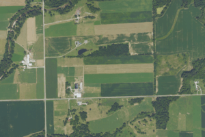
Bowman has been awarded three new task orders totaling $4.8 million from the U.S. Department of Agriculture (USDA) National Agriculture Imagery Program (NAIP). Bowman is one of only five firms nationwide authorized to perform large-scale NAIP aerial imagery acquisition and processing.
The task orders cover aerial data acquisition and processing across 17 states and are being executed under Bowman’s existing FPAC Geospatial Enterprise Operations (GEO) PINE Blanket Purchase Agreement—a long-term contract vehicle that enables recurring revenue and feeds a growing pipeline of federal tasking. As part of this effort, Bowman deployed Phase One PAS Pana digital imaging systems to acquire 60-centimeter and 30-centimeter resolution imagery at traditional 60-centimeter altitudes, enabling higher-fidelity data collection in less time and at lower operating cost.
Bowman’s next-generation digital imaging systems improve operational efficiency and strengthen competitive positioning in federal and commercial geospatial procurement. By capturing multi-resolution at high altitude, Bowman delivers orthoimaging results at a highly competitive cost while building a multi-purpose, comprehensive repository of premium, high-resolution imagery that can support projects across federal and commercial portfolios.
Tags:Aerial ImageryNewsOrthoimageryProject Award
Share