
For local governments, developers and planners, the health of the urban tree canopy is more than just an environmental concern—it’s a data challenge. Where are trees growing? Where are they disappearing? How can communities prioritize investments in green infrastructure?
In this Bowman Perspectives Q&A, we sit down with Cornell Rowan CP, senior project manager to talk about the evolving world of canopy management and how Bowman’s next-gen mapping technologies are helping cities make better, faster and greener decisions.
Q: Why is tree canopy management becoming such a big deal for cities and counties?
A: Tree canopy plays a huge role in cooling neighborhoods, reducing stormwater runoff, improving air quality—you name it. But as development ramps up, it’s harder to keep track of what’s being lost and where we need to replant. As communities grow and development intensifies, protecting and expanding green infrastructure becomes more complex. That’s why more communities are looking for smarter, data-driven ways to manage their urban forests.
Q: What makes tree canopy management so challenging?
A: The biggest challenge is visibility. Many places are working with old or incomplete data. They don’t know exactly where the trees are, how many they have or how that’s changed over time. Without that info, it’s tough to plan new plantings, protect existing trees or measure the benefits of green space.
Q: How does Bowman help clients get that ‘clear picture’?
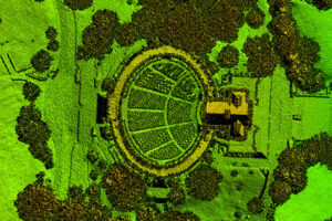
A: Bowman deploys a novel geospatial data collection method using a dual-sensor approach, which simultaneously captures high-resolution aerial imagery and LiDAR elevation data. This allows us to capture any required ground sample distance (GSD) imagery and any quality level LiDAR datapoints per square meter, that can be processed into a detailed 3D point cloud.
Q: What are the benefits of combining imagery and LiDAR for tree canopy studies?
A: When you combine imagery and LiDAR, you get the best of both worlds—high-resolution visuals plus the hard measurements to back them up. The LiDAR point cloud shows tree height, structure and location, while imagery provides context and clarity. Our team processes the data into GIS-ready layers, which allows users to filter by region, track trends over time and quickly identify areas that need attention.
Q: How does this data translate into action for local governments or developers?
A: Cities can plug this data right into their GIS systems and start spotting trends—like which neighborhoods are losing canopy, or where they’re meeting sustainability goals. It also helps with things like:
- Planning new tree planting programs
- Updating zoning and landscape policies
- Applying for environmental grants
- Making the case for green infrastructure funding
It’s all about turning raw data into real action.
About Cornell Rowan, CP
With more than 40 years of experience in survey and photogrammetry, Cornell Rowan brings deep technical expertise and strong leadership to Bowman’s geospatial team. He specializes in resource allocation, logistics planning and production management, overseeing projects from planning through delivery. Cornell manages scopes of work, coordinates with clients and internal teams and leads all phases of project execution—including surveying, aerial imagery and LiDAR acquisition, aerial triangulation, LiDAR processing, planimetric and topographic feature collection and digital orthoimagery production.